
Cumberland County Previous Residents Sources
A backward address trail works best as an era map. Cumberland County deeds provide the deepest verified ownership layer, while the parcel map establishes the land that needs to be followed. Directories and census schedules can add household evidence when a specific volume or released schedule covers the relevant place and date. Civil, estate, map, imagery, permit, newspaper, and obituary records can narrow a timeline, but each has limits. A recorded owner is not automatically an occupant, and a dated record does not establish every person living there.
| Source | Years it covers | Where held | What it shows |
|---|---|---|---|
| Recorder deeds | 1750-present, as stated by the county | Landex and Recorder of Deeds | Grantor and grantee links, recording placement, and legal-description continuity. |
| Mortgage index | 1973-present | Recorder/Landex | Recorded financing or lien history, not a residence list. |
| Miscellaneous recorded index | 1956-present | Recorder/Landex | Other recorded instruments; coverage differs from deeds and mortgages. |
| County Archives deed-grantee index | Historical records; exact series years not stated | County Archives | Grantee, grantor, instrument type, and book or page placement. |
| Historical Society directory collection | Exact directory years not publicly verified | Cumberland County Historical Society | Possible household, address, and occupation leads after staff confirms a volume. |
| Federal census | Released through 1950 | NARA and library genealogy access | Household snapshot on its enumeration date. |
| Marriage and estate records | 1994-present online; earlier open records in person | Register of Wills and Clerk of Orphans’ Court | Family and probate leads, subject to record-type access rules. |
| Municipal permit or code file | Varies by municipality; no countywide span verified | Correct borough or township office | A dated property event, applicant, or work record, not a household roster. |
Begin a Cumberland County search with Property Mapper when the address is known. Begin with the Recorder when a deed book and page or a prior owner is known. For an older person or household question, ask the Historical Society or library whether a relevant directory exists, then pair it with the nearest released census. The Cumberland County access path changes with the question.
Cumberland County Parcel First
Previous residents research begins with land, not a surname. The Cumberland County Property Mapper accepts a street number and street name or a PIN. A map click can select a parcel, and the county says the selected parcel opens a left panel with assessment data. Save only the fields actually displayed, together with the PIN, municipality, map context, and legal description if available. The Property Mapper guide does not verify every detail field, a name search, or a street-wide resident list.
The Cumberland County Recorder of Deeds page describes the next record custodian and its office access.
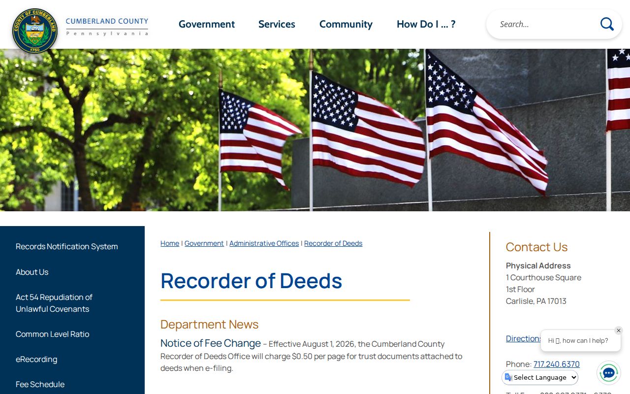
The Cumberland County Recorder route is for recorded documents and title research. It does not turn an address into a verified list of people who lived there.
A situs address identifies land. A mailing address identifies where tax correspondence goes and may be a post-office box, trust agent, business, or another location. Cumberland County cautions that online property sources omit some owner mailing addresses. Treat a mailing field as a lead, not proof of residence.
Cumberland County Past Owner Chain
The Recorder of Deeds is Cumberland County’s core ownership source. The county says deeds have been maintained and can be searched back to 1750 through Landex. The index is organized around parties and recorded placement, rather than a verified street-address browse. That structure is why a careful title trail starts from the parcel, then searches the current owner as grantee, checks the legal description, and follows the prior grantor to that person’s incoming deed.
- Search the current street number in Property Mapper and record the PIN, municipality, and parcel details actually shown.
- Preserve the legal description or lot, block, subdivision, and plan information when it is available. It is the continuity check for the land.
- Search the present recorded owner as a grantee in Landex, then check the instrument type, recorded date, book or page, and legal description.
- Write down the seller or grantor named in that deed. Search that person as an earlier grantee to locate the prior acquisition.
- Repeat the comparison backward, carrying the same parcel description rather than trusting a name or street number alone.
- When a result is unclear, use Recorder office searching or the County Archives deed-grantee index to verify the book and page trail.
- Grantor / grantee
- The grantor transfers an interest in the recorded instrument. The grantee receives that interest. In a purchase deed, the seller is normally the grantor and the buyer the grantee.
- Chain of title
- A sequence of recorded ownership transfers for one parcel. It is not a roster of everyone who occupied the property.
- Legal description
- The lot, block, subdivision, metes-and-bounds, or similar parcel wording used in land records. It can remain stable when a street name, postal label, or house number changes.
- Situs address
- The physical property address used to locate land. It differs from a mailing address and may not appear the same way in older records.
Cumberland County Previous Residents Deed Coverage
Cumberland County coverage dates are not interchangeable. Recorder deeds are stated as 1750-present, mortgages as 1973-present, and miscellaneous documents as 1956-present. A missing mortgage or miscellaneous filing does not mean that the deed chain has ended. It means the document category has a different stated reach. This distinction is a useful check when tracing previous residents through an address history without turning every recorded event into occupancy evidence.
The Landex access route is the Recorder’s named online portal for deed search and review.

Landex should be approached as a Cumberland County party, instrument, date, book, and page search. The research did not verify every live dropdown, an address-search field, image fee, or image-access condition, so those details require checking in the current portal.
County Archives provides a second, historical aid through its A to Z Deeds Index - Grantees. Its described fields are grantee name, grantor name, instrument type, and book or page location. The index supplies record placement. The deed and parcel description still supply the land match.
Cumberland County Legal Description Trail
Old addresses can fail for ordinary reasons. A road may have a different form in a directory, a postal city may not match the municipality, a subdivision can be replatted, or the house number may change. No authoritative Cumberland County street-renumbering date was verified, so it would be wrong to supply a conversion date or assume two similar addresses are the same place. The legal description, plan, lot, municipality, map reference, and adjacent parcels are the better bridge.
Compare the Cumberland County Property Mapper parcel against the deed language each time the trail changes hands. If a name is common, use the instrument date, book or page, and neighboring lot information to resolve it. A legal description is not glamorous, but it prevents a history from jumping to the wrong parcel.
Note: A correct ZIP or mailing city does not establish the borough, township, or parcel identity used for land and permit records.
Cumberland County Previous Residents Dating Clues
Ownership records do not always date visible changes to a property. Cumberland County Map Services says Property Mapper uses 2024 imagery by default and offers seven prior years. That makes the imagery sequence a modest change-detection tool for the recent past. It can suggest when a structure, addition, road pattern, or cleared area changed, but imagery cannot identify past residents.
For a Cumberland County permit, code case, utility-related event, or local file, identify the parcel’s municipality first and ask the correct borough or township open-records officer for existing records. A targeted Pennsylvania Right-to-Know Law request should give the address, date span, and record type. Agencies ordinarily respond within five business days; a written interim response can extend the expected date under the statute’s rules. Asking for a record is different from asking an office to create a residency history.
The Cumberland County Map Services page describes the parcel, assessment-panel, print, and imagery context. Municipal files can document work, an applicant, or an event. They do not prove every person who occupied an address.
Cumberland County Household Timeline
Past owners and past households are separate questions. A person can own property while living elsewhere, and a household can appear in a directory without owning the parcel. Cumberland County Historical Society holdings include city directories, maps, tax lists, census records, newspapers, genealogy material, and manuscripts, but the inspected public source does not publish exact directory years or reverse-directory runs. Cumberland County staff confirmation comes before an address search in a historical volume.
For a known Cumberland County name or street, compare the closest available directory years with the nearest released census. The federal census is released after 72 years, and 1950 is the latest released decennial schedule. Match a person on a combination of surname, spouse, occupation, employer, street, children, or contiguous households. A directory entry might be a business address, while census information records a household at a particular enumeration date.
- Ask the Historical Society or library for the town, date range, title, publisher, and whether a reverse or criss-cross volume exists.
- Transcribe the exact entry and the front-matter abbreviation key. Do not assume standard household-status, widow, or boarding marks.
- Check the next and prior available directory. Compare several details before treating similarly named entries as one person.
- Pair the strongest result with the closest released federal census and record the census enumeration date.
- Test a move or absence with a deed, tax list, historic map, newspaper, obituary, cemetery record, or probate file.
The historical shelf and entry-reading limits are described in the Cumberland County city directory collections. Keep ownership and household evidence in separate columns while building a timeline.
Lawful use. Use previous-resident research for house history, family history, estate work, and personal curiosity. Do not use names or addresses to track, threaten, intimidate, or harass any living person.
Cumberland County Previous Residents Map Clues
Historic Cumberland County maps can fill a geographic gap, not a household list. The Library of Congress historic Cumberland map shows rural householders’ names and borough parcel or lot detail. It can link a family name to a road, township, or land pattern when a directory is missing. Check the map’s date and compare it with the deed description and later records.
New Cumberland Community Archives adds another Cumberland County local option for that community, with photographs, records, maps, and newspapers. Shippensburg Historical Society has its own archives, deeds, maps, photographs, and artifacts. These repositories can explain place and time, but none was verified as a countywide prior-occupant index.
Cumberland County Previous Residents Endpoints
A death, obituary, cemetery record, or probate file can close a Cumberland County historical trail or identify family connections. Pennsylvania’s State Archives holds mature birth and death material under its published archival access ranges, while the Department of Health has a separate current certified-copy route. Cumberland County marriage and estate records are online from 1994 forward; earlier open records are available at the Register of Wills office. Adoption and guardianship records have restricted access and should not be treated as general address research.
For an heir question, begin with the Register of Wills and preserve the estate number, filing date, and relationship evidence. For an older death, use the applicable archival index and request route, then compare it with an obituary, directory, census, or deed. No single endpoint proves a whole household history. The combined dated record trail is stronger and less likely to confuse people with the same name.
Family-history use. An estate, mature death record, obituary, and directory can document an heir trail when each source is checked for date, place, and relationship. The result remains a historical reconstruction, not a current-resident roster.